


The Mouth of the Seine: City of Reinvention

Project idea
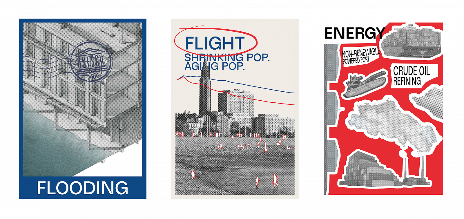
Le Havre, a historically significant coastal city at the mouth of the Seine, is at a critical juncture. Despite its UNESCO-listed architecture and powerful industrial legacy, the city faces three urgent and interlinked challenges: flooding, population flight, and energy transition.
First, Le Havre’s geographic position and industrial expansion have rendered it acutely vulnerable to flooding, particularly in its low-lying industrial zones. Projections show that many of these areas lie within the 100-year floodplain, threatening economic stability and urban resilience.
Second, the city is experiencing a slow demographic decline. Without a rapid transit link to Paris, Le Havre remains spatially and economically distant from the capital, pushing residents to migrate to suburbs or other urban centres with better connectivity, services, and employment prospects. The existing urban fabric is too expansive for its current population, leading to inefficiencies in infrastructure use and diminished vibrancy in underpopulated districts.
Third, like many post-industrial port cities, Le Havre is tethered to carbon-intensive energy systems. A successful transition to green energy is not only environmentally necessary but also key to redefining the city's economic base and attracting future investment.
This constellation of challenges has created a cityscape that is increasingly vulnerable, and out of sync with contemporary environmental and social dynamics. Yet these same pressures also offer an opportunity for radical rethinking.
The masterplan responds to this moment with a set of strategic demands: to confront the flood risk not by resisting it, but by working with it; to reverse population flight through high-speed connectivity and densified urban vibrancy; and to lead in the shift towards a sustainable, resilient, and ecologically integrated urban future.
Project description
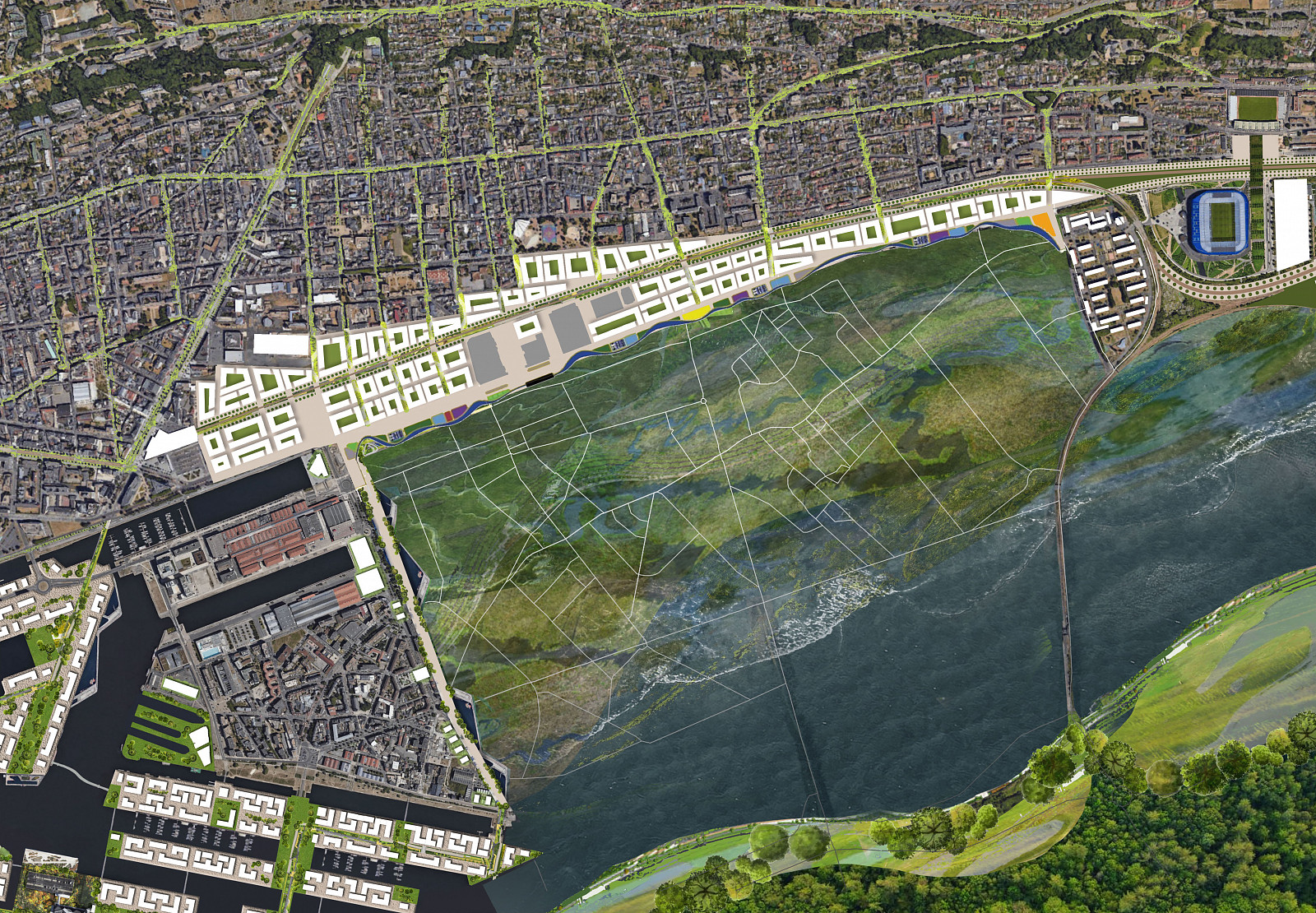
The proposed masterplan for Le Havre envisions a transformative urban evolution grounded in resilience, reclamation, and reconnection. Rather than fighting the sea, the city learns to coexist with it—redefining its geography and urban logic through an adaptive, layered approach that leverages natural systems and infrastructural foresight.
At the heart of the intervention is a new high-speed TGV rail connection to Paris, reducing travel time to approximately 40 minutes. This infrastructural leap repositions Le Havre as a satellite city of the capital, reversing trends of outmigration and making it a viable, attractive alternative for both residents and businesses seeking a more sustainable and affordable coastal lifestyle.
Simultaneously, the city’s underutilised and low-density areas—particularly those at high risk of flooding—are strategically surrendered to the sea. These zones are transformed into a vast National Park, an ecologically rich and publicly accessible landscape that reclaims space for biodiversity, water management, and leisure, turning past liabilities into future assets.
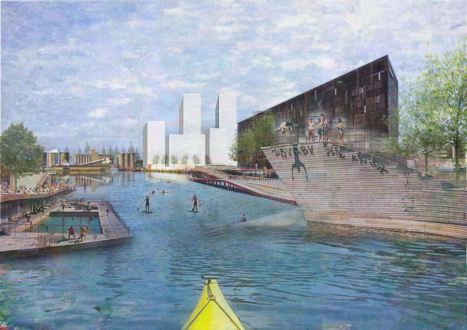
To protect Le Havre’s historic core and key urban districts, the plan introduces a resilient sponge-edge: an infrastructural and ecological buffer zone behind the industrial waterfront. This multifunctional band acts as both flood defence and active public space, integrating wetlands, promenades, and urban forests. In doing so, it not only safeguards the city’s architectural heritage but also creates a new, high-value waterfront edge, catalysing development and offering the city a revitalised interface with the water.
The masterplan also proposes a bold geographic extension: an archipelago of islands within the Seine, introducing a new typology of waterside living. This intervention draws inspiration from Le Havre’s own history—as the city itself was originally formed as an archipelago of islands—reclaiming and reinterpreting its geographic origins in a contemporary context. These islands host housing, community infrastructure, and green public spaces, forming a unique hybrid of urban and aquatic life, while reinforcing the city’s identity as both a port and a living ecosystem.
The overall strategy follows a simple yet profound principle: let go of what no longer serves the city, protect what is essential, and densify what remains. By consolidating the urban footprint into more compact, vibrant, and connected zones, Le Havre becomes more efficient, more liveable, and more resilient. The city’s fading vitality is re-energised through the creation of high-value, nature-integrated districts that support both economic growth and ecological regeneration.
Ultimately, this is not a preservationist plan nor a tabula rasa. It is an adaptive framework for an evolving city—one that accepts the inevitability of environmental change and responds with humility, and ambition. Le Havre becomes a prototype for 21st-century coastal urbanism: resilient to rising tides, reconnected to its region, and redefined by its relationship with the land, the sea, and its people.
Technical information
The Le Havre masterplan supports France’s 2050 climate goals by transforming the city into a model for sustainable urban and industrial development. It integrates renewable energy, circular construction, ecological restoration, and green mobility to support a projected population growth of 60,000.
Le Havre will shift away from fossil fuels, with the port becoming fully electric and powered by offshore wind and tidal sources in line with EU shore power regulations. Green hydrogen will replace fossil-based hydrogen for maritime use. Repurposed fuel silos will act as sand batteries, storing excess renewable energy as heat to supply a city-wide ambient loop heating system. Industrial waste heat will also be recovered. Existing buildings, including vacant properties, will be retrofitted to high energy-efficiency standards to reduce demand and rehouse 11,200 residents displaced by flood risk.
A new high-speed rail line will reduce travel time between Le Havre and Paris—from over two hours to under one—via Rouen. This will improve air quality, reduce traffic congestion, and increase land values around transit nodes. Additionally, 35 km of sustainable public transport infrastructure, including cable cars and 50 km of new cycle lanes will support low-carbon mobility, cutting emissions by 170,000 tonnes of CO₂ annually.
Based on the projected growth, the plan includes 23,000 new energy-efficient homes (20% social housing), 23 primary schools, 3 secondary schools, and 23 GP surgeries. Vacant and flood-risk buildings, including warehouses, will be dismantled. Recovered materials—steel, brick, concrete, timber, glass, and tiles—will be reused in new construction. Locally sourced, low-carbon materials such as calcined clay and regional red and yellow clays will reduce embodied carbon while maintaining local architectural character.
A new 520-hectare national park and urban greening initiative will introduce nearly 600,000 trees, sequestering an estimated 12,500 tonnes of CO₂ annually. This landscape-led approach will restore natural estuary habitats, support biodiversity, and create resilient ecosystems across the urban region.
Documentation
Copyright © 2026 INSPIRELI | All rights reserved. Use of this website signifies your agreement to the Terms of Use, Privacy Policy, and use of cookies.
