


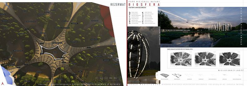


BioSphere Reserve – Urban nature park

Project idea
The project is an attempt to create a multifunctional open urban space for both humans and animals, holistically combining infrastructure, architecture and nature into one synergistically functioning organism.
Sustainability, eco-friendliness, biodiversity, ecological restitution, biomimetics and water-sensitive design are slogans describing the idea of a designer trying to create a valuable space focused on the hidden value of mitigation and combating climate change.
Project description
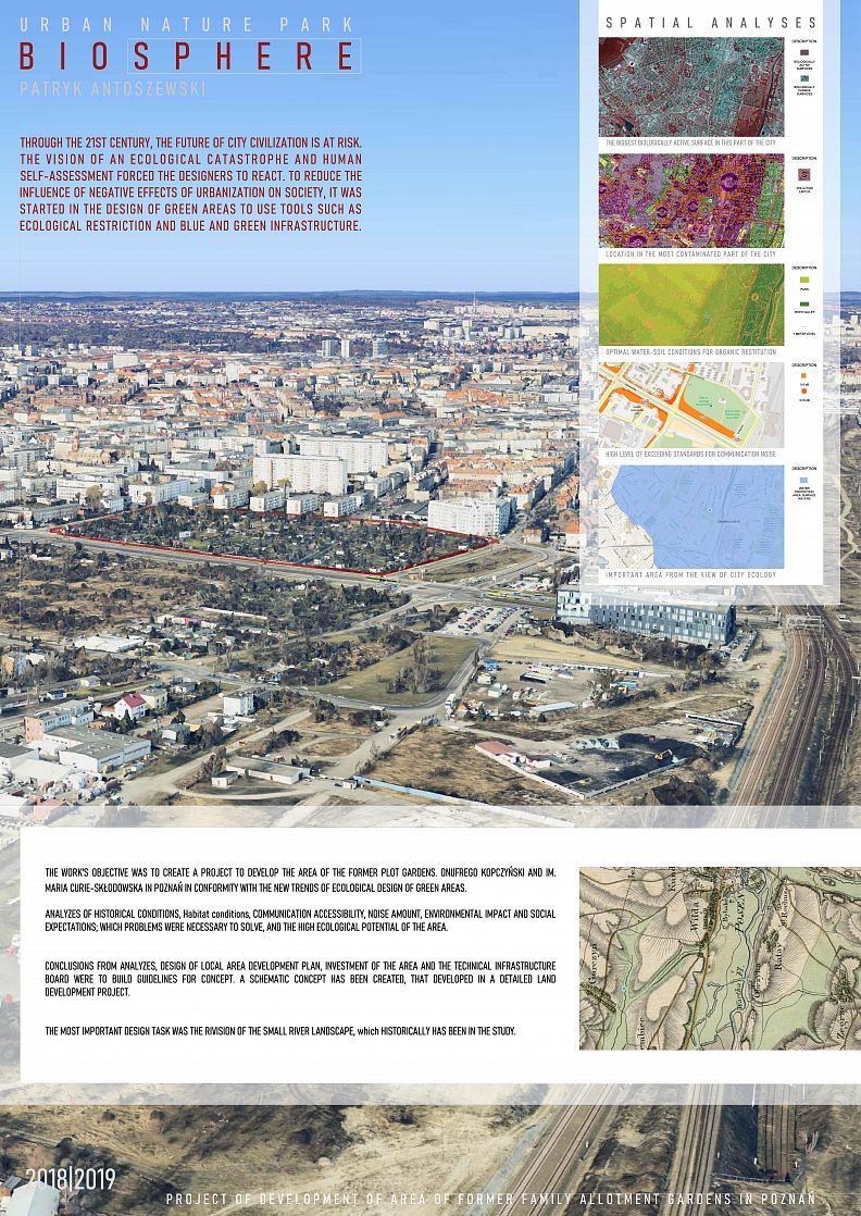
In the twenty-first century, the future of urban civilization is under threat. The vision of ecological disaster and self-annihilation of humanity forced designers to react. Tools such as ecological restoration and blue-green infrastructure are used in the design of green areas to reduce the impact of the negative effects of urbanization on society.
Poznań is known for its characteristic urban greenery arrangement. However, this system is constantly being degraded. The area of Family Allotment Gardens Onufry Kopczyński and Maria Curie-Skłodowska historically connected with this system is an important point in the current natural structure of the city. The Poznań authorities wanting to protect this area against its urbanization have set a new direction for development possibilities for him, allowing the conversion of the ROD into a city park with partial preservation of the current function.
Various types of analyzes were carried out to check the current conditions of the concept development area. An analysis of historical conditions showed that in the place of allotment gardens there once existed a valley of the small river Górczynka, which was also confirmed by an analysis of habitat conditions, which further showed that abiotic conditions have not changed significantly since then. Due to the analysis of communication accessibility, communication problems and future possibilities of the facility were shown. An important problem of the area occupied by the ROD is noise, which resulted from the analysis of noise intensity. Surroundings of plots belong to the medium attractive, which can be read from the analysis of the visual attractiveness of the surroundings. An extensive analysis of the impact on the environment shows that this area has a very important ecological buffer for this part of the city and can be an open sport and recreation area desired by the local community (analysis of social expectations).
The new land development project for Family Allotments assumed the creation of a multifunctional space with functional, social, cultural, recreational, ecological, didactic and communication functions. As part of the utility function, a social garden was created, which is a restructured form of allotment gardens. The social function is a place of meetings and social integration represented by the rich equipment of the park with various types of utility facilities. Developed functional and utility program in the form of, among others group activities and the possibility of practicing even unusual sports is responsible for the implementation of the recreational function. The cultural program of the facility consists of cyclical events such as concerts, exhibitions, film screenings, etc. The didactic function is mainly played by the didactic path.
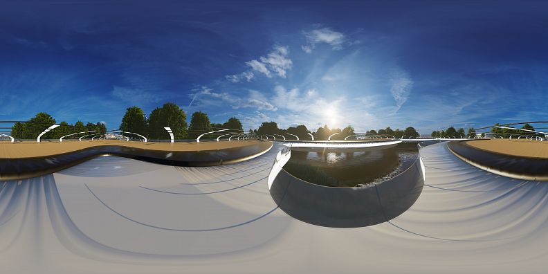
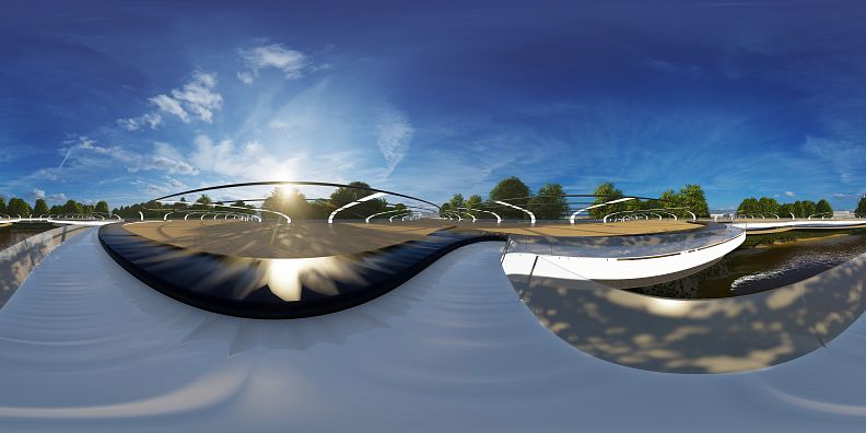
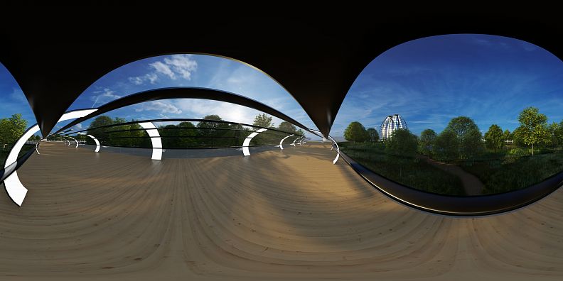
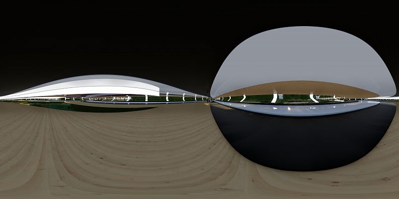
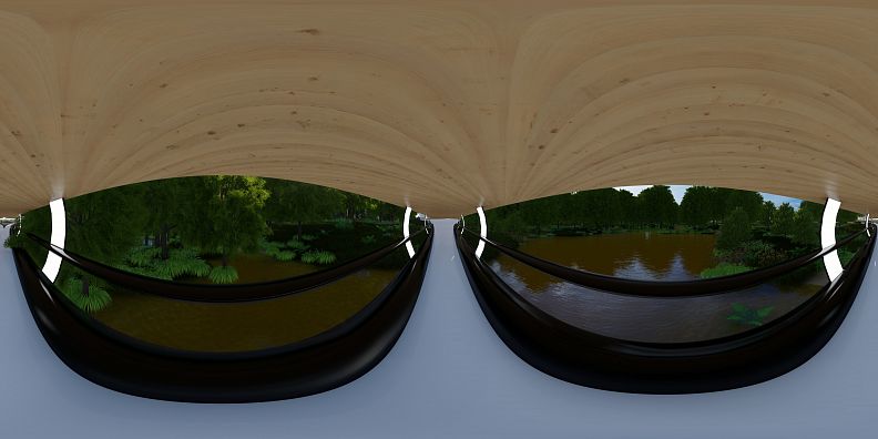
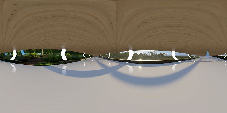
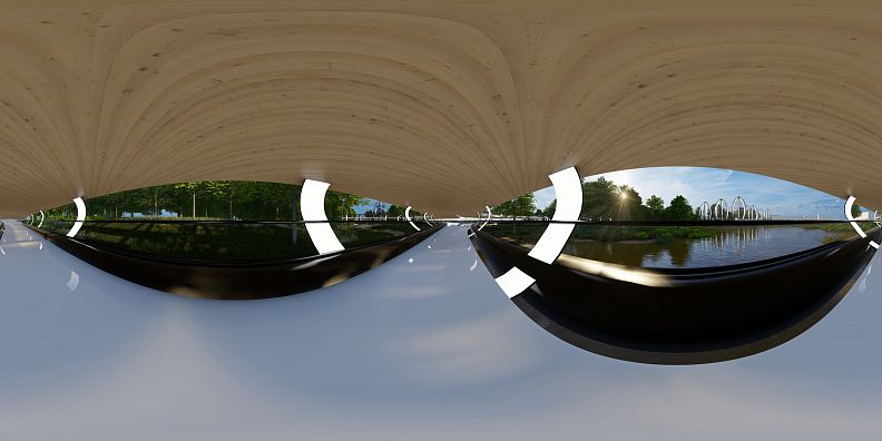
In the park, communication has been resolved in the form of multi-layer non-invasive infrastructure. The communication layer includes two levels of movement within the park. The protective layer is made of acoustic screens, which are also balustrades. The shielding layer is made of elements responsible for shadow generation. The technical layer is a structural element that is also responsible for lighting. The last layer consists of elements for relaxation located on both communication levels.
The entire development area, on which the river and its valley and floodplains have been restored, is responsible for fulfilling the extensive ecological functions. New vegetation was introduced in the facility, which consists of ten different plant complexes adapted to new abiotic conditions. The park is equipped with an ecohydrological system responsible for surface retention, infiltration and purification of water carried by the restored river.
The final verification of the project in terms of its sustainability has shown that this development concept meets the requirements of the ecosystem services, blue-green infrastructure and biomimicry assumptions.
The facility, through its pro-ecological development, will definitely increase the biodiversity of the area, improve environmental conditions, and significantly improve the quality of life of the local community. His task is also to build ecological awareness of the inhabitants of Poznań from an early age and to promote good practices in landscape architecture.
Technical information
1. Function
The facility has been adapted to perform the functions of: utility, recreation, social, cultural, didactic, ecological and communication.
Each of them supports internal tasks subordinate to a given function.
Utility function
As part of the utility function, a social garden was created to maintain the main utility function of the Family allotment garden.
Recreational function
A park program was prepared to suit a wide age range of recipients and people with disabilities, including: obstacle course, social garden, picnic clearing and observation point. Active (didactic path) and passive recreation (multifunctional infrastructure) places were created. The property additionally supports bicycle traffic.
Social function
A place for meetings and interpersonal conversations was created. The multifunctional center supports this function.
Cultural function
An exhibition and stage space was created within the multifunctional center and a cultural program consisting of cyclical cultural events such as concerts, exhibitions, lectures, film screenings, festivals, food events, activating sports activities, guided tours, animal observations, sports competitions, workshops and artistic locations.
Didactic function
As part of the didactic function, a didactic path with ten stops was created. The beginning and end of the educational trail is at the observation point. The path was adapted to different age of recipients and to move in a wheelchair.
Ecological function
Support for the ecological function included the creation of ten natural habitats similar to natural, animal protection and support for the development of biodiversity through the construction of city hives, hotels for insects and breeding boxes for birds and bats. In addition, care was taken to improve the microclimatic conditions of the park's surroundings by increasing the biologically active area and introducing a developed water retention system, thereby increasing the non-urbanized drainage basin of the Górczynka River. The components of the park's water system are also engineering structures aimed at vaporization and condensation of water vapor both inside and outside the park.
Communication function
A centrally integrated network of cycling paths runs through the park. The upper level belongs to the through network. It can be quickly moved in any direction through the park. It supports bicycle traffic. The lower level supports only pedestrian traffic due to the location at this level of exhibition and stage space. Traffic here is slow. The park is also surrounded by a beltway that allows for encircling the Park without having to go deeper into it. All pedestrian and bicycle infrastructure was adapted to the existing roads adjacent to the development site. A parking space was also created where there was a car park, a bicycle park and a Poznań City Bike station.
2. Space
The northern part of the park was equipped with openwork green providing the possibility of insight into the park to residents of blocks adjacent to the study area. This greenery creates an acoustic screen limiting the propagation of sound coming from Potocka Street. Placing murals on the empty tops of blocks in the immediate vicinity of the park is diversified by a view from the park towards the north.
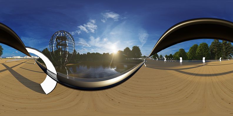
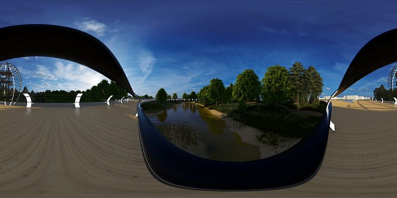
The eastern part of the park was exposed. The place is picturesque, the floor creates a lake and low vegetation surrounds it. This view is wide and shows a full panorama of the park. Due to its exposure, this area had to be lowered the most. This avoided noise propagation of the future PST city tram route. There are no trees in this place, which allowed the greenhouse buildings of the social garden to be located within this part of the park. The greenhouse exhibition in this place is most favorable due to the southern exhibition.
The southern part has been gradually lowered to the center of the park, which will allow to reduce noise coming from Hetmańska Street. An additional measure was the introduction of a multi-storey greenery arrangement for the same purpose. It also allowed to limit the view of the uninteresting busy street. In the southern corner a biofiltration reservoir was created with the mouth of the Górczynka river into the combined sewage system.
The western part was planted with high openwork greenery. In this part, the obstacle course and rope park infrastructure was created. There is also an observation point here, which is the starting station of the educational trail, from which there is a view of the entire park. This area is relatively flat and falls only closer to the center.
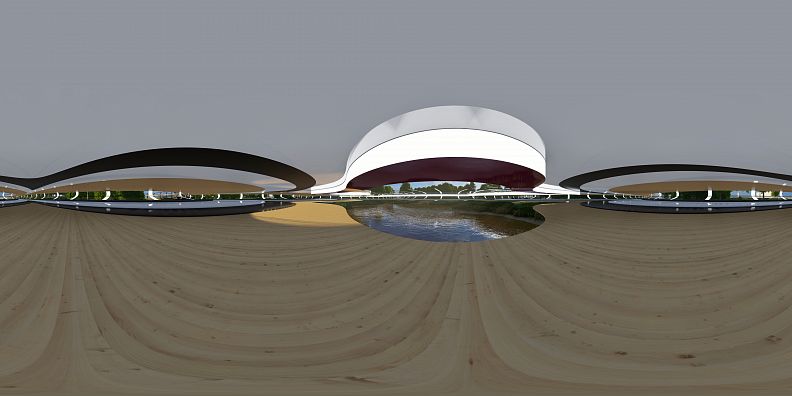
All elements of passive recreation infrastructure were located in the Center. Elements responsible for social and cultural functions were also created here. The residential building in this place, which was a construction arbitrariness, was removed. Most elements of the water system were also placed here, including: preliminary settling tank, sedimentation and filtration tank, biological treatment plants, retention and infiltration tank and centrally located retention tank.
The entire area was surrounded by a low transparent sound-absorbing screen to reduce noise reaching the center of the park.
The following materials were used to create building elements and infrastructure: wood composite, polyvinylidene fluoride (PVDF), anodized steel, architectural concrete, glass. The colors were maintained: iridescent black, white, gray, natural wood. In addition, a burgundy color accent was introduced.
Lack of utilities of the area allowed for full profiling of the area, collision-free planting of trees and location of building foundations and infrastructure within it.
3. Nature
A park was created referring stylistically to natural areas. After creating specific abiotic conditions by supplying water and profiling the area to varying degrees, ten different plant communities were introduced. In each type of habitat, nesting boxes were placed and places for observing birds and bats were created. Educational trail stations appeared at each type of vegetation, allowing for thorough familiarization with the plant community being watched. Sound-absorbing barriers have been routed in such a way that they prevent small animals from entering the road from all sides. Water reservoirs were restocked in accordance with the species adaptation to the habitat type, and a grate was installed at the inlet to the combined sewage system to prevent fish flowing down the river. Small animals such as frogs, lizards and hedgehogs have the opportunity to reach the park through the culvert under Hetmańska Street. Electricity used in the park is fully renewable and obtained locally using PVDF flooring.
The following plant associations were introduced into the park: fresh subatlantic pine forest - Leucobryo-Pinetum. Dicrano-Pinetum, Myrtillo-Pinetum, Central European oak-hornbeam - Galio sylvatici-Carpinetum betuli, ash alder riparian forest - Fraxino-Alnetum, alder currant - Ribeso nigri-Alnetum, high-class ryegrass - Arrhenatheretum elatioris, molinia meadow - Molinietum caeruleae, seabed rush - Caricetum ripariae, mud sedge - Caricetum acutiformis, water lily and white waterlily association - Nupharo-Nymphaeetum albae, knotweed association - Potametum lucentis.
4. Communication
In the northern part of the park there is a car and bicycle parking junction where the Poznań City Bicycles station is also located.
Transit traffic runs diagonally, the width of the pedestrian and bicycle path has been adapted to high pedestrian traffic. The main road was raised to a level equal to the roads surrounding the site. The lower level, which only provides pedestrian traffic, lies below the level of the surrounding ground, which ensures that it is cut off from the surrounding noise park. At the intersection of communication routes a specific square was created with a notch in the center. This square is the center of the park. In order to get priority cars directly to the center of the Park, a technical road was connected to ul. Łukaszewicza. For now, the next route from the south to the center of the park is less important. In the future, its outlet will be located opposite the office center being built on the other side of Hetmańska Street. Both levels of communication run parallel under each other and the inputs are at the same point.
The nature trail surrounds the entire area and has been laid on paved ground without leveling the ground. Its beginning and end is the observation point in the western part of the park.
5. Organization
The object was given the name "Biosphere Reserve". The park could be created after the land consolidation of both RODs. Green areas within the park are available to everyone. The park has a website where all information about the park's equipment, plans for visiting the park, description of ecosystems within the park, operation of the hydrological system and current schedule of cultural events are available. The greenery in the park is maintenance free. The minimum amount of work must be put into clearing the paths of branches and mowing the picnic meadow. In order to maintain order and prevent vandalism, the park has been equipped with a monitoring system. A decentralized park management system was created and power over it was transferred to the bodies responsible for its maintenance (Greenery Board, Housing Estate Council, Education Centers). In this way, a greater number of authorities are responsible for caring for the park, which can contribute to its better functioning.
6. Sustainability
The project was verified in order to check sustainability and become part of ecological trends. The project results were verified in terms of their adjustment to: ecosystem services assumptions, blue-green infrastructure assumptions and biomimetics assumptions.
7. Restructuring
In addition to adapting to all the assumptions of pro-ecological design mentioned above, the object meets, above all, the main objectives of Family Allotment Gardens.
Created in:
Copyright © 2025 INSPIRELI | All rights reserved. Use of this website signifies your agreement to the Terms of Use, Privacy Policy, and use of cookies.
