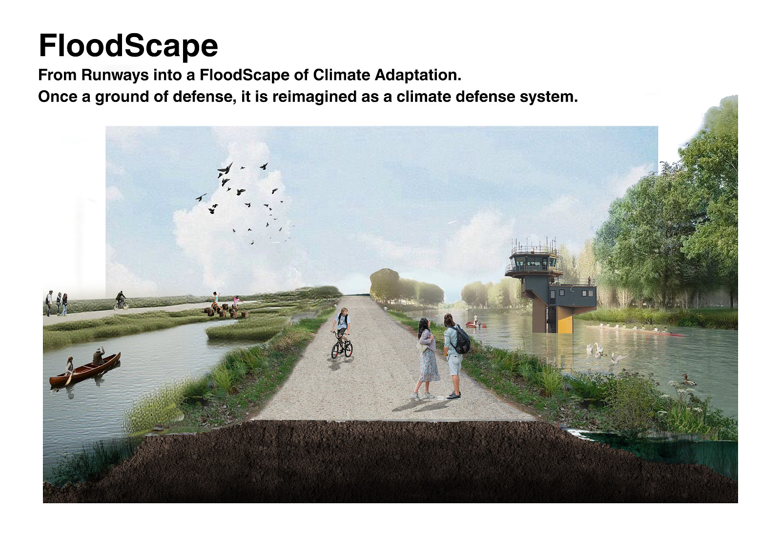


Floodscape

Idea projektu
FloodScape proposes the transformation of an abandoned military airport into a climate-adaptive landscape system, shifting its role from rigid defense infrastructure to a productive and resilient environment. Once designed for control, separation, and exclusion, the former runway is reimagined as an open framework that negotiates between water, ecology, and human activity.
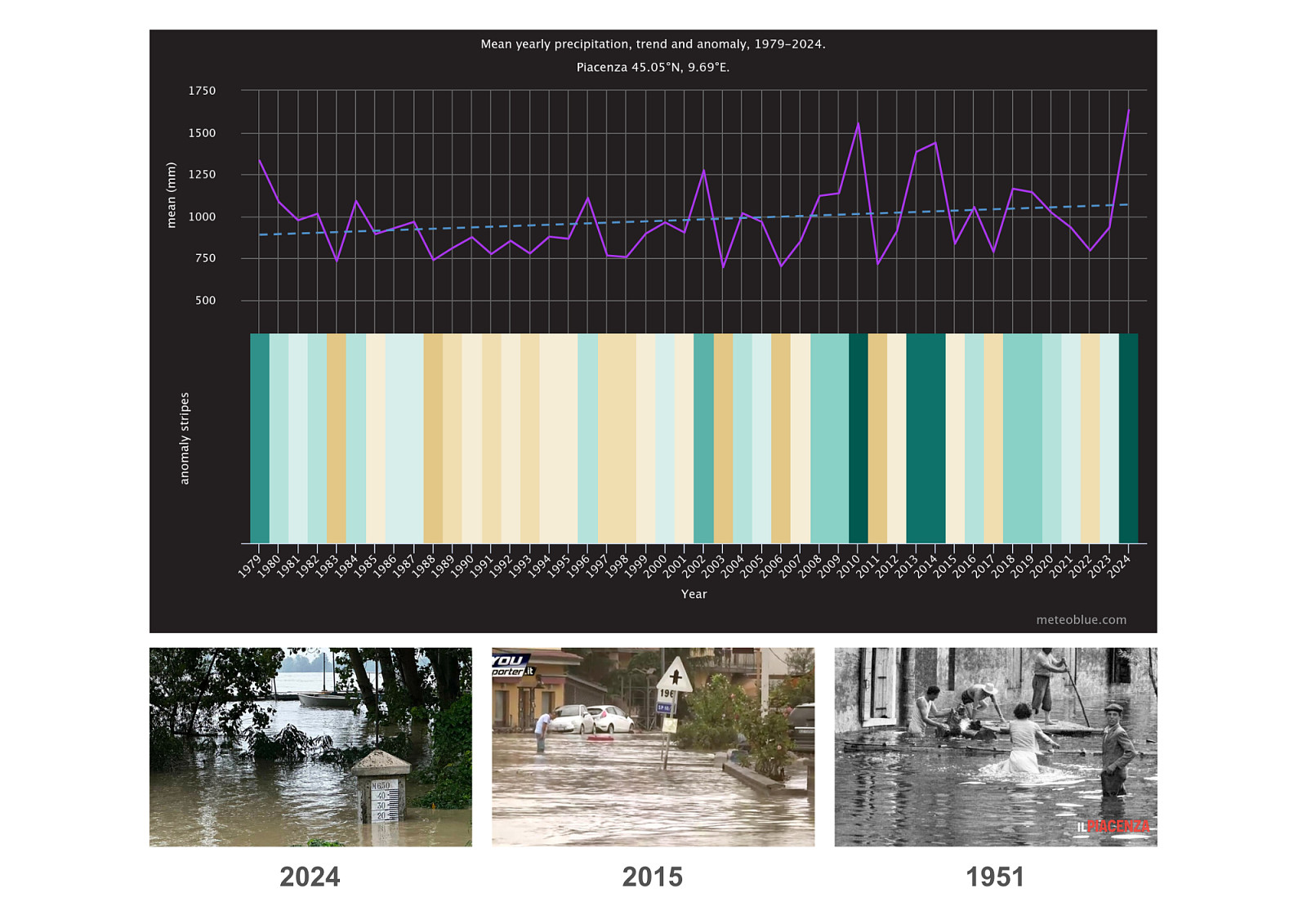
As climate change intensifies rainfall patterns and flood events, large mono-functional infrastructures such as military airports become increasingly vulnerable and obsolete. These expansive sealed surfaces, originally engineered to resist natural processes, now amplify flood risk. FloodScape addresses this condition by redefining the abandoned airfield as a landscape of adaptation rather than resistance.
Instead of protecting the site through conventional hard defenses, the project introduces a scenario-based flood landscape capable of operating under varying water levels. The design allows water to enter the site in a controlled manner, transforming excess rainfall into a resource that is stored, filtered, and gradually released back into the environment.
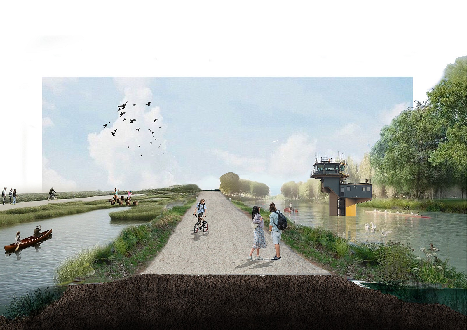
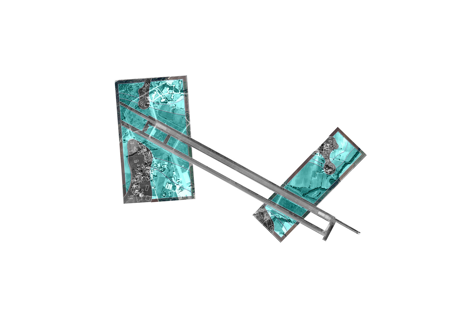
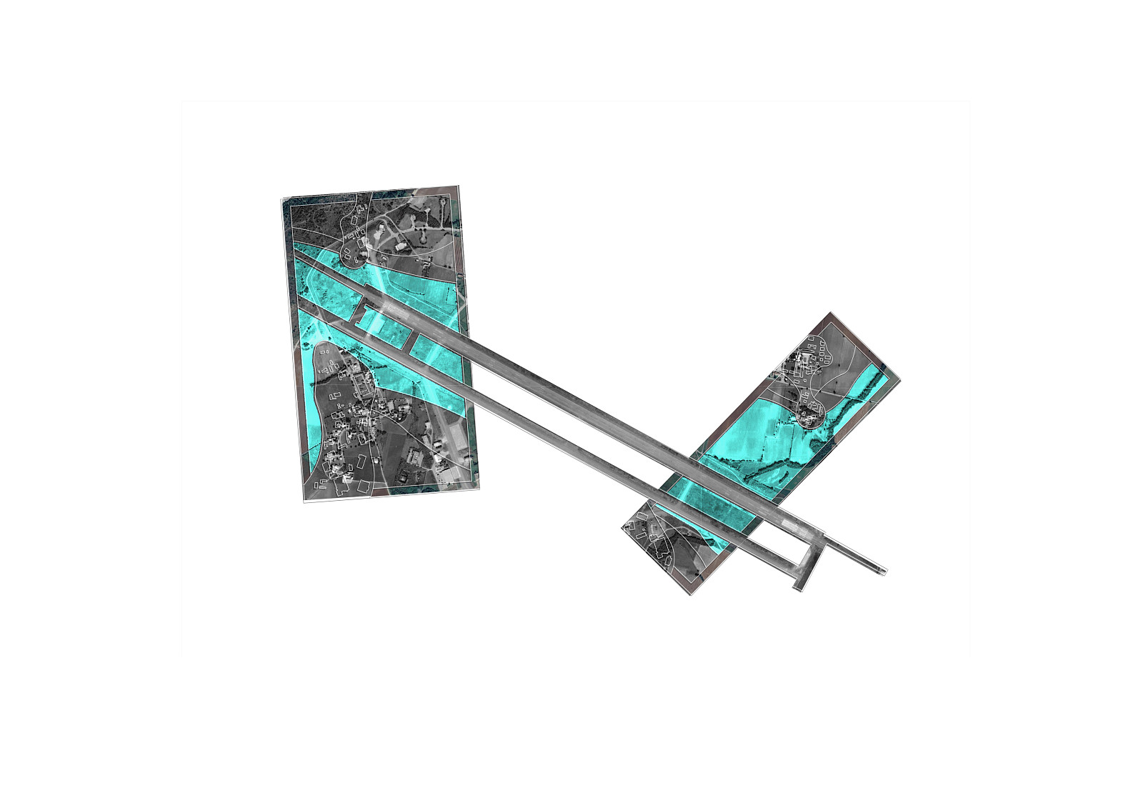
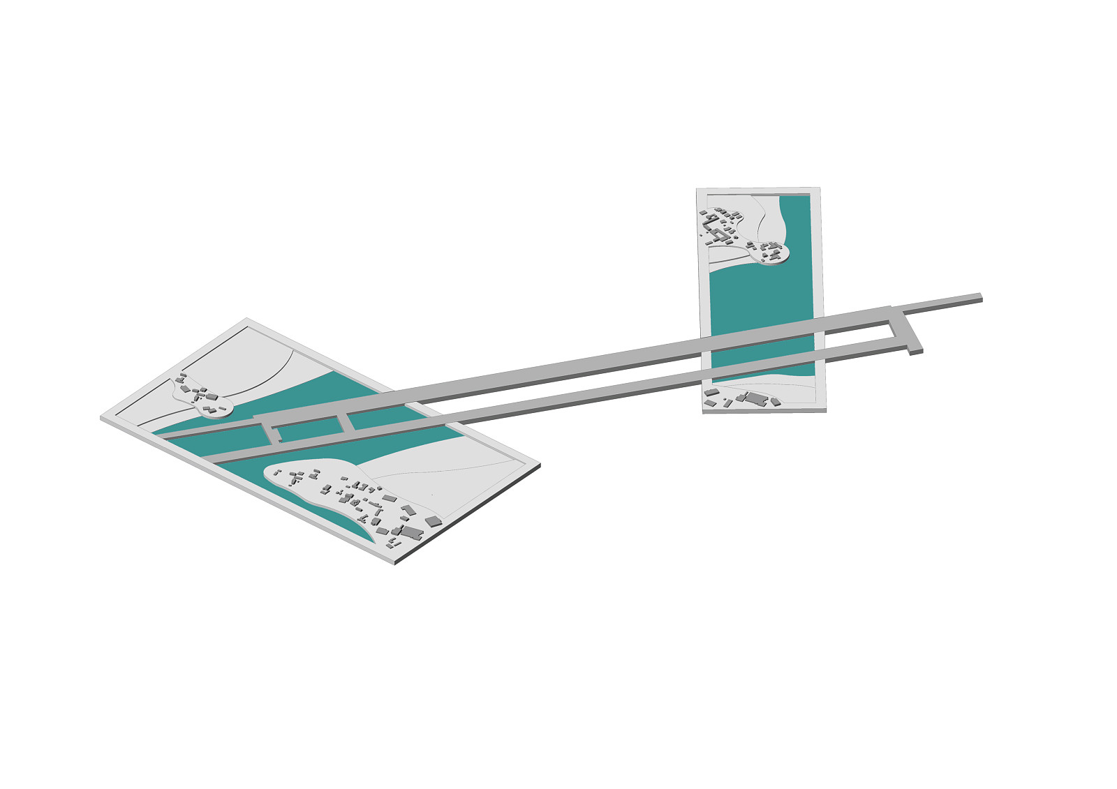
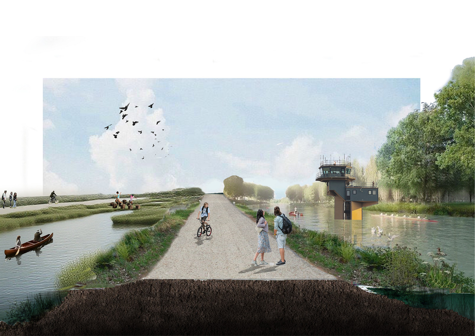
The former runway becomes a linear infrastructural spine, maintaining its role as a connector while shifting its function to regulate movement, access, and water flow across the territory. This spine links fragmented land parcels and organizes the landscape into zones that respond differently to flooding, ensuring both ecological performance and human safety.
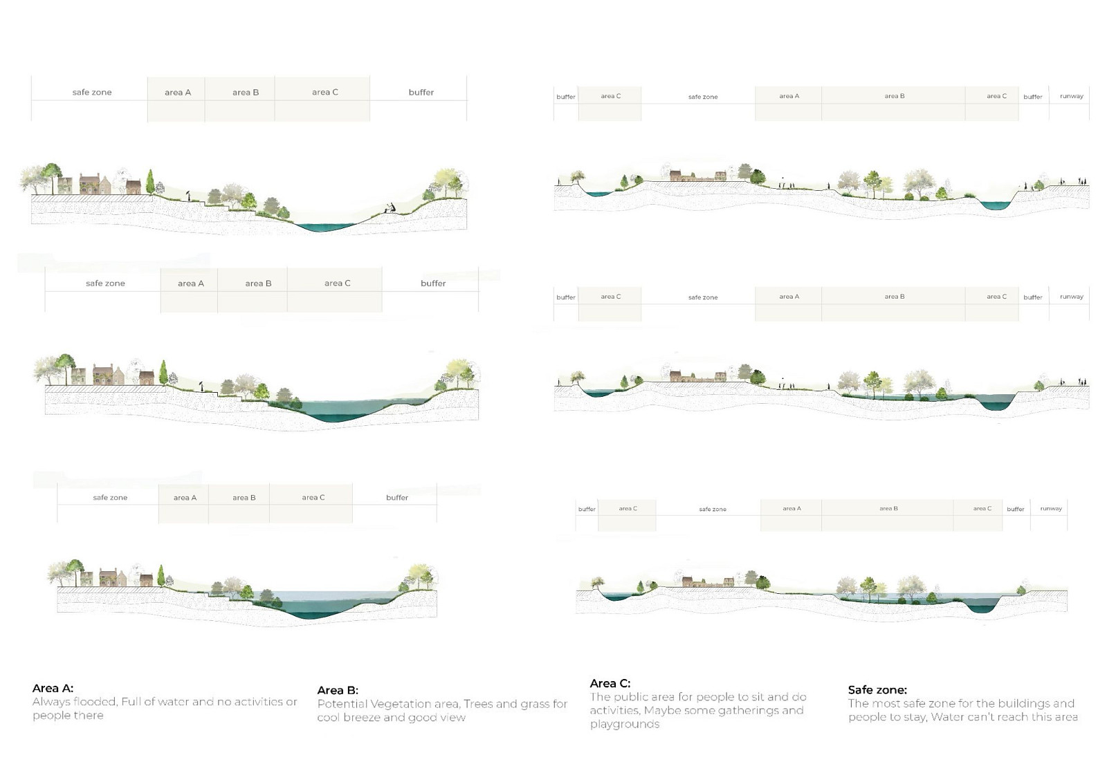
FloodScape structures the site through a layered territorial logic, ranging from permanently flooded zones with no occupation, to vegetated buffer landscapes that support biodiversity and cooling, and finally to elevated safe zones where long-term human activities and structures remain protected. Each layer is activated according to flood intensity, allowing the landscape to adapt dynamically rather than fail catastrophically.
By transforming an abandoned military airport into a living floodscape, the project challenges traditional notions of infrastructure, defense, and land use. FloodScape demonstrates how obsolete systems of control can be reprogrammed into open, resilient landscapes, where climate risk becomes a catalyst for ecological regeneration and spatial innovation.
Popis projektu
FloodScape is a landscape and infrastructural transformation project that reclaims an abandoned military airport and reprograms it into a resilient system capable of responding to increasing flood risks driven by climate change. Once designed as a rigid, sealed, and mono-functional territory, the former airfield is reinterpreted as an adaptive landscape where water, ecology, and human activity coexist through controlled processes rather than conflict.
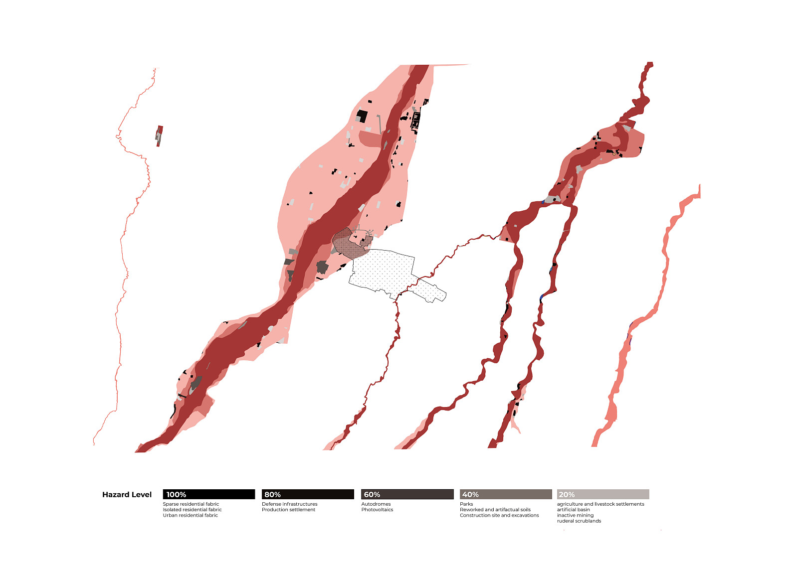
The project begins by acknowledging the existing condition of the site: vast impervious runways, fragmented land parcels, and disconnected edges that intensify surface runoff and flood vulnerability. Instead of erasing this legacy, FloodScape builds upon it. The former runway is retained as a linear infrastructural spine, becoming the main organizer of movement, access, and water regulation across the site. This spine connects different landscape zones while maintaining its historical trace as a line of control, now transformed into a framework of resilience.
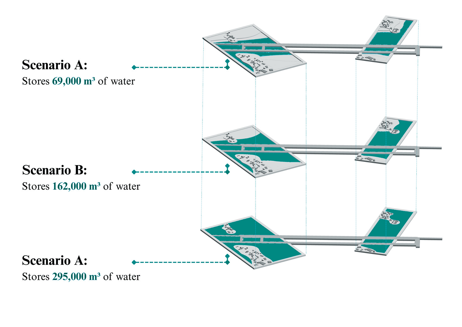
The landscape is structured through a scenario-based flood management system, allowing the site to operate under varying levels of rainfall and water accumulation. Rather than relying on a single design condition, the project anticipates multiple flooding scenarios, each activating different areas of the site. Water storage capacity increases progressively, enabling the landscape to respond safely to moderate, severe, and extreme flood events without structural failure.
FloodScape divides the territory into distinct functional zones based on accessibility, risk, and ecological performance. Permanently flooded areas are designated as non-accessible zones, supporting water retention and ecological regeneration. Surrounding these are vegetated buffer landscapes that slow water flow, improve infiltration, and enhance biodiversity. Elevated safe zones are strategically positioned to remain dry under all scenarios, allowing for long-term human occupation and essential infrastructure.
Sectionally, the project introduces a carefully graded topography that accommodates controlled inundation. Water is guided, stored, and released through landform modulation rather than hard engineering alone. This approach transforms flooding from a destructive force into a visible and manageable process embedded within everyday spatial experience.
Through its integration of infrastructure, landscape design, and climate-responsive planning, FloodScape redefines obsolete military land as a living system of adaptation. The project demonstrates how abandoned infrastructures can be transformed into resilient territories that absorb risk, restore ecological function, and provide long-term spatial value in the face of environmental uncertainty.
Technické informace
Site & Existing Infrastructure
FloodScape is located on an abandoned military airport, characterized by large impervious runway surfaces, minimal vegetation, and fragmented surrounding land. The existing runway structure is retained and reused as a primary infrastructural spine, reducing demolition while preserving the historical and spatial logic of the site. This spine organizes circulation, access, and water management across the project.
Flood Management Strategy
The project is based on a scenario-driven flood management system, designed to accommodate increasing rainfall intensity and extreme weather events.
Scenario 01 (Low Flood Event):
Limited water accumulation is stored in shallow basins integrated into the landscape, maintaining full public accessibility.
Scenario 02 (Medium Flood Event):
Additional retention zones are activated, allowing controlled inundation of vegetated buffer areas while safe zones remain dry.
Scenario 03 (Extreme Flood Event):
Maximum water storage capacity is reached, with permanently flooded zones fully activated and access restricted to elevated safe areas.
This phased activation ensures that flooding is absorbed gradually, preventing sudden system failure.
Water Storage & Capacity
The landscape is engineered to progressively store increasing volumes of water through a combination of basins, depressions, and controlled overflow paths. Storage capacity expands from approximately 69,000 m³ during low events to 162,000 m³ during medium scenarios, reaching up to 295,000 m³ under extreme conditions. Water is temporarily retained and then slowly released back into the natural hydrological system.
Zoning & Risk Classification
The site is divided into zones based on flood tolerance and accessibility:
Permanent Flood Zones:
Non-accessible areas designed for long-term water storage and ecological regeneration.
Buffer Zones:
Landscaped areas with flood-tolerant vegetation that slow water flow, improve infiltration, and filter pollutants.
Safe Zones:
Elevated areas protected from flooding under all scenarios, accommodating circulation paths, infrastructure, and potential built elements.
This zoning ensures clarity between inhabitable and non-inhabitable areas during flood events.
Topography & Sectional Design
Artificial landforms are introduced to manipulate water behavior without heavy reliance on mechanical systems. Gradual slopes, stepped terraces, and retention basins guide water movement across the site. Sectional design allows controlled flooding while maintaining structural and environmental stability.
Environmental Impact
By transforming sealed runway surfaces into absorbent landscapes, FloodScape significantly reduces surface runoff, mitigates flood risk downstream, and enhances local biodiversity. The project shifts flood management from defensive infrastructure to landscape-based resilience, offering a long-term, adaptable response to climate change.
Copyright © 2026 INSPIRELI | All rights reserved. Use of this website signifies your agreement to the Terms of Use, Privacy Policy, and use of cookies.
